Dordogne
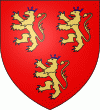 |
The county of Périgord dates back to when the area was inhabited by the Gauls. It was originally home to four tribes. The name for "four tribes" in the Gaulish language was "Petrocore". The area eventually became known as the county of Le Périgord and its inhabitants became known as the Périgordins (or Périgourdins). There are four Périgords in the Dordogne.
* The "Périgord Vert" (Green Périgord), with its main town of Nontron, consists of verdant valleys in a region crossed by many rivers and streams;.
* The "Périgord Blanc" (White Périgord), situated around the department's capital of Périgueux, is a region of limestone plateaux, wide valleys, and meadows.
* The "Périgord Pourpre" (Purple Périgord) with its capital of Bergerac, is a wine region.
* The "Périgord Noir" (Black Périgord) surrounding the administrative center of Sarlat, overlooks the valleys of the Vézère and the Dordogne, where the woods of oak and pine give it its name.
The Petrocores took part in the resistance against Rome. Concentrated in a few major sites are the vestiges of the Gallo-Roman period-–the gigantic ruined tower and arenas in Périgueux (formerly Vesone), the Périgord museum's archaeological collections, villa remains in Montcaret, and the Roman tower of La Rigale Castle in Villetoureix. The earliest cluzeaux (artificial caves either above or below ground) can be found throughout the Dordogne. These subterranean refuges and lookout huts were large enough to shelter entire local populations. According to Julius Caesar, the Gauls took refuge in these caves during the resistance.
After Guienne province was transferred to the English Crown under the Plantagenets following the remarriage of Eleanor of Aquitaine in 1152, Périgord passed by right to English suzerainty. Being situated at the boundaries of influence of the monarchies of France and England, it oscillated between the two dynasties for more than three hundred years of struggle until the end of the Hundred Years' War in 1453. The county had been torn apart and, as a consequence, that modeled its physiognomy.
During the calmer periods of the late 15th and early 16th centuries, the Castillon plain on the banks of the Dordogne saw a development in urban architecture. The finest Gothic and Renaissance residences were built in Périgueux, Bergerac, and Sarlat. In the countryside, the nobility erected the majority of the more than 1200 chateaux, manors and country houses. In the second half of the 16th century, however, war was waged in the area, as the attacks, pillaging, and fires of the Wars of Religion reached a rare degree of violence in Périgord. At the time, Bergerac was one of the most powerful Huguenot strongholds, along with La Rochelle. Following these wars, Périgord, fief of Henry of Navarre, was to return to the Crown for good and would continue to suffer from the sudden political changes of the French nation, from the Revolution to the tragic hours of the Resistance.
We also encounter the memory of the region's most important literary figures: Arnaut Daniel, Bertran de Born, Michel de Montaigne, Étienne de La Boétie, Brantôme, Fenelon, Maine de Biran, Eugene Le Roy, and André Maurois; its great captains: Talleyrand, Saint-Exupéry, Biron; and even entertainer and activist Josephine Baker. A number of ruins (La Chapelle-Faucher, I'Herm) have retained the memory of the tragedies that took place within their walls. Several of the castles and châteaux are open to visitors; some of them, such as Bourdeilles and Mareuil, house noteworthy collections.
Map - Dordogne
Map


Country - France
 |
 |
| Flag of France | |
Inhabited since the Palaeolithic era, the territory of Metropolitan France was settled by Celtic tribes known as Gauls during the Iron Age. Rome annexed the area in 51 BC, leading to a distinct Gallo-Roman culture that laid the foundation of the French language. The Germanic Franks formed the Kingdom of Francia, which became the heartland of the Carolingian Empire. The Treaty of Verdun of 843 partitioned the empire, with West Francia becoming the Kingdom of France in 987. In the High Middle Ages, France was a powerful but highly decentralised feudal kingdom. Philip II successfully strengthened royal power and defeated his rivals to double the size of the crown lands; by the end of his reign, France had emerged as the most powerful state in Europe. From the mid-14th to the mid-15th century, France was plunged into a series of dynastic conflicts involving England, collectively known as the Hundred Years' War, and a distinct French identity emerged as a result. The French Renaissance saw art and culture flourish, conflict with the House of Habsburg, and the establishment of a global colonial empire, which by the 20th century would become the second-largest in the world. The second half of the 16th century was dominated by religious civil wars between Catholics and Huguenots that severely weakened the country. France again emerged as Europe's dominant power in the 17th century under Louis XIV following the Thirty Years' War. Inadequate economic policies, inequitable taxes and frequent wars (notably a defeat in the Seven Years' War and costly involvement in the American War of Independence) left the kingdom in a precarious economic situation by the end of the 18th century. This precipitated the French Revolution of 1789, which overthrew the Ancien Régime and produced the Declaration of the Rights of Man, which expresses the nation's ideals to this day.
Currency / Language
| ISO | Currency | Symbol | Significant figures |
|---|---|---|---|
| EUR | Euro | € | 2 |
| ISO | Language |
|---|---|
| EU | Basque language |
| BR | Breton language |
| CA | Catalan language |
| CO | Corsican language |
| FR | French language |
| OC | Occitan language |